
AIPNZ Vol 4 Amendment Back Issue 26/4 - 16 APR 26
$18.00 NZD
Back Amendment for Volume 4 effective 16 April 2026.

AIPNZ Vol 4 Amendment Back Issue 26/6 - 11 JUN 26
$18.00 NZD
Back Amendment for Volume 4 effective 11 June 2026.

AIPNZ Volume 1 Updates - Effective 12 June 2025
$0.00 NZD
The attached file includes the Volume 1 Amendment effective from 12 June 2025.
AIPNZ Volume 1 Updates - Effective 17 April 2025
$0.00 NZD
The attached file includes the Volume 1 Amendment effective from 17 April 2025.
AIPNZ Volume 1 Updates - Effective 7 August 2025
$0.00 NZD
The attached file includes the Volume 1 Amendment effective from 7 August 2025.

AIPNZ Volume 2&3 Updates - Effective 12 June 2025
$0.00 NZD
The attached file includes the Volume 2 & 3 Amendments effective from 12 June 2025
AIPNZ Volume 2&3 Updates - Effective 17 April 2025
$0.00 NZD
The attached file includes the Volume 2 & 3 Amendments effective from 17 April 2025
AIPNZ Volume 2&3 Updates - Effective 7 August 2025
$0.00 NZD
The attached file includes the Volume 2 & 3 Amendments effective from 7 August 2025

AIPNZ Volume 4 Updates - Effective 12 June 2025
$0.00 NZD
The attached file includes the Volume 4 Amendment effective from 12 June 2025.
AIPNZ Volume 4 Updates - Effective 17 April 2025
$0.00 NZD
The attached file includes the Volume 4 Amendment effective from 17 April 2025.
AIPNZ Volume 4 Updates - Effective 7 August 2025
$0.00 NZD
The attached file includes the Volume 4 Amendment effective from 7 August 2025.

Auckland Oceanic FIR Chart - Effective 13 June 2024
$30.67 NZD
Covers Auckland Oceanic Flight Information Region (FIR)
For more information about the New Zealand's Oceanic and Domestic FIRs, refer to AIP New Zealand.

B1/B2 VNC Northland / Auckland / Marlborough / Canterbury - (1:500,000) - 27 November 2025
$14.50 NZD
Effective 27 November 2025
This chart is 1:500,000 scale at an A1 sheet size and covers:
Northland / Auckland
Marlborough / Canterbury
Visual Navigation Charts (VNC) are intended for pre-fli...

B3/B4 VNC Tairawhiti / Canterbury / Otago - (1:500,000) - 27 November 2025
$14.50 NZD
Effective 27 November 2025
This chart is 1:500,000 scale at an A1 sheet size and covers:
Tairawhiti
Canterbury/Otago
Visual Navigation Charts (VNC) are intended for pre-flight planning and ...

B5/B6 VNC Wellington / Taranaki / Southland - (1:500,000) - 27 November 2025
$14.50 NZD
Effective 27 November 2025
This chart is 1:500,000 scale at an A1 sheet size and covers:
Wellington/Taranaki
Southland
Visual Navigation Charts (VNC) are intended for pre-flight planning an...

C1/C2 VNC Northland/Wellington - (1:250,000) - 27 November 2025
$14.50 NZD
Effective 27 November 2025
This chart is 1:250,000 scale at an A1 sheet size and covers:
Northland
Wellington
Visual Navigation Charts (VNC) are intended for pre-flight planning and in-fl...

C11/C12 VNC Waikato/Buller - (1:250,000) - 27 November 2025
$14.50 NZD
Effective 27 November 2025
This chart is 1:250,000 scale at an A1 sheet size and covers:
Waikato
Buller
Visual Navigation Charts (VNC) are intended for pre-flight planning and in-flight na...

C13/C14 VNC Kaikoura/Invercargill - (1:250,000) - 27 November 2025
$14.50 NZD
Effective 27 November 2025
This chart is 1:250,000 scale at an A1 sheet size and covers:
Kaikoura
Invercargill
Visual Navigation Charts (VNC) are intended for pre-flight planning and in-...

C15/C16 VNC Fiordland/Westland - (1:250,000) - 27 November 2025
$14.50 NZD
Effective 27 November 2025
This chart is 1:250,000 scale at an A1 sheet size and covers:
Fiordland
Westland
Visual Navigation Charts (VNC) are intended for pre-flight planning and in-fligh...

C17/C18 VNC Queenstown/Tasman - (1:250,000) - 27 November 2025
$14.50 NZD
Effective 27 November 2025
This chart is 1:250,000 scale at an A1 sheet size and covers:
Queenstown
Tasman
Visual Navigation Charts (VNC) are intended for pre-flight planning and in-flight...

C19/C20 VNC Dunedin/Christchurch - (1:250,000) - 27 November 2025
$14.50 NZD
Effective 27 November 2025
This chart is 1:250,000 scale at an A1 sheet size and covers:
Dunedin
Christchurch
Visual Navigation Charts (VNC) are intended for pre-flight planning and in-fli...

C3/C4 VNC Auckland North/Hawke's Bay - (1:250,000) - 27 November 2025
$14.50 NZD
Effective 27 November 2025
This chart is 1:250,000 scale at an A1 sheet size and covers:
Auckland North
Hawke's Bay
Visual Navigation Charts (VNC) are intended for pre-flight planning and ...

C5/C6 VNC Napier/Gisborne/Auckland South - (1:250,000) - 27 November 2025
$14.50 NZD
Effective 27 November 2025
This chart is 1:250,000 scale at an A1 sheet size and covers:
Napier/Gisborne
Auckland South
Visual Navigation Charts (VNC) are intended for pre-flight planning ...

C7/C8 VNC Marlborough/Bay of Plenty - (1:250,000) - 27 November 2025
$14.50 NZD
Effective 27 November 2025
This chart is 1:250,000 scale at an A1 sheet size and covers:
Marlborough
Bay of Plenty
Visual Navigation Charts (VNC) are intended for pre-flight planning and i...

C9/C10 VNC Mackenzie/Taranaki - (1:250,000) - 27 November 2025
$14.50 NZD
Effective 27 November 2025
This chart is 1:250,000 scale at an A1 sheet size and covers:
Mackenzie
Taranaki
Visual Navigation Charts (VNC) are intended for pre-flight planning and in-fligh...

COMPLETE AIP Tonga - Digital Version only - Effective 12 June 2025
$0.00 NZD
Access to this information is free - once you have completed your order you will be given access to download the PDF.
Please note the following:
Publications marked DRAFT are unverifi...
COMPLETE AIP Tonga - Digital Version only - Effective 19 February 2026
$0.00 NZD
Access to this information is free - once you have completed your order you will be given access to download the PDF.
Please note the following:
Publications marked DRAFT are unverifi...
COMPLETE AIP Tonga - Digital Version only - Effective 27 November 2025
$0.00 NZD
Access to this information is free - once you have completed your order you will be given access to download the PDF.
Please note the following:
Publications marked DRAFT are unverifi...
COMPLETE AIP Tonga - Digital Version only - Effective 30 October 2025
$0.00 NZD
Access to this information is free - once you have completed your order you will be given access to download the PDF.
Please note the following:
Publications marked DRAFT are unverifi...
COMPLETE AIP Tonga - Digital Version only - Effective 6 August 2026
$0.00 NZD
Access to this information is free - once you have completed your order you will be given access to download the PDF.
Please note the following:
Publications marked DRAFT are unverifi...

D1/D2 VNC Auckland/Christchurch - (1:125,000) - 27 November 2025
$14.50 NZD
Effective 27 November 2025
This chart is 1:125,000 scale at an A1 sheet size and covers:
Auckland Terminal Area
Christchurch Terminal Area
Visual Navigation Charts (VNC) are intended for pre...

D3/D4 VNC Queenstown/Manawatu - (1:125,000) - 27 November 2025
$14.50 NZD
Effective 27 November 2025
This chart is 1:125,000 scale at an A1 sheet size and covers:
Queenstown Terminal Area
Manawatu Terminal Area
Visual Navigation Charts (VNC) are intended for pre-f...

Digital Auckland Oceanic FIR Chart PDF - Effective Date 13 June 2024
$30.67 NZD
Digital A1/A2 Visual Planning Chart (North Island/South Island)
Effective Date: 13 June 2024
Scale: 1:250,000
Format: PDF
NOTE: As this is a digital item you must accept the Digital End Us...
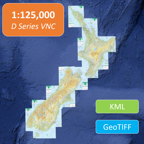
Digital Visual Navigation Charts 1:125,000 scale (Chart Areas) - Effective 27 November 2025
$12.00 NZD
Digital versions of the New Zealand 1:125 000 scale (D Series) Visual Navigation Charts (VNCs) offered in both Geo-referenced TIFF and KML formats.
Use the drop down boxes to select a specific c...

Digital Visual Navigation Charts 1:250 000 scale (Chart Areas) - Effective 27 November 2025
$12.00 NZD
Digital versions of the New Zealand 1:250 000 scale (C Series) Visual Navigation Charts (VNCs) offered in both Geo-referenced TIFF, KML and MBTiles file formats.
Use the drop down boxes to selec...
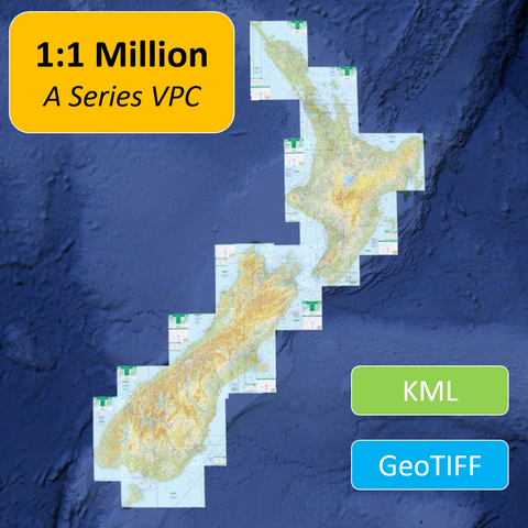
Digital Visual Navigation Charts 1:500,000 scale (Chart Areas) - Effective 27 November 2025
$12.00 NZD
Digital versions of the New Zealand A Series Visual Planning Charts (VPCs) offered in both Geo-referenced TIFF and KML formats.
Use the drop down boxes to select a specific chart area or the who...

Digital Visual Navigation Charts 1:500,000 scale (Chart Areas) - Effective 27 November 2025
$12.00 NZD
Digital versions of the New Zealand 1:500 000 scale (B Series) Visual Navigation Charts (VNCs) offered in both Geo-referenced TIFF, KML and MTiles file formats.
Use the drop down boxes to select...

Enroute and Area Charts - Effective Date 11 June 2026
$30.67 NZD
NOTES:
1. Enroute charts are updated twice a year in May and November and are included as part of the Volume 2 & 3 AIPNZ Amendment Service.
2. Standalone Volume 2 & 3 contents do n...

Enroute and Area Charts - Effective Date 27 November 2025
$30.67 NZD
NOTES:
1. Enroute charts are updated twice a year in May and November and are included as part of the Volume 2 & 3 AIPNZ Amendment Service.
2. Standalone Volume 2 & 3 contents do n...

Enroute Chart Pack (Digital PDF) - Effective 11 June 2026
$31.00 NZD
A complete set of the New Zealand Enroute and Area Charts.
Effective Date: 11 June 2026
Updates: Every 6 months in May and November each year
Format: PDF (Not Geo-referenced)
COVERAGE:
Th...

Enroute Chart Pack (Digital PDF) - Effective 27 November 2025
$31.00 NZD
A complete set of the New Zealand Enroute and Area Charts.
Effective Date: 27 November 2025
Updates: Every 6 months in June and December each year
Format: PDF (Not Geo-referenced)
COVERAG...

Hard Cover Binder 70 mm, Cover & Spine Set suits AIPNZ Vol 3
$14.28 NZD
This is an empty binder that is suitable for use for the NZ AIP Volume 3 and includes Binder Cover & Spine Sets.
NOTE:
This item does not include the AIP content. You can order the relevan...

Hard Cover Binder 70 mm, Cover, Spine & Tab Set suits AIPNZ Vol 1
$14.28 NZD
This is an empty binder that is suitable for use for the NZ AIP Volume 1 and includes Binder Cover, Spine & Tab Sets
NOTE:
This item does not include the AIP content. You can order the rel...

Hard Cover Binder 70 mm, Cover, Spine & Tab Set suits AIPNZ Vol 2
$14.28 NZD
This is an empty binder that is suitable for use for the NZ AIP Volume 2 and includes Binder Cover, Spine & Tab Sets
NOTE:
This item does not include the AIP content. You can order the rel...
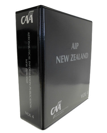
Hard Cover Binder 70 mm, Cover, Spine & Tab Set suits AIPNZ Vol 4
$14.28 NZD
This is an empty binder that is suitable for use for the NZ AIP Volume 4 and includes Binder Cover, Spine & Tab Sets
NOTE:
This item does not include the AIP content. You can order the rele...

New Zealand AIP Volume 1 - CONTENTS ONLY
$68.00 NZD
AIP Volume 1 - CONTENTS ONLYIf you have not updated your AIP for sometime this is a good option if you still have a binder you wish to use.
Effective Date: 11 June 2026
This contents includes ...
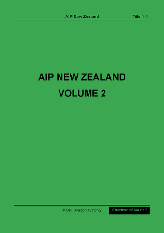
New Zealand AIP Volume 2 - CONTENTS ONLY (NOT including Vol 3 or Enroute Charts)
$71.00 NZD
AIP Volume 2 - CONTENTS ONLYIf you have not updated your AIP for sometime this is a good option if you still have binders you wish to use.
Instrument flying in New Zealand requires both Volume 2...

New Zealand AIP Volume 3 - CONTENTS ONLY (NOT including Vol 2 or Enroute Charts)
$75.00 NZD
AIP Volume 3 - CONTENTS ONLYIf you have not updated your AIP for sometime this is a good option if you still have binders you wish to use.
Instrument flying in New Zealand requires both Volume 2...

New Zealand AIP Volume 4 - CONTENTS ONLY
$66.00 NZD
AIP Volume 4 - CONTENTS ONLYIf you have not updated your AIP for sometime this is a good option if you still have a binder you wish to use.
Effective Date: 11 June 2026
This contents includes...

New Zealand Visual Navigation Chart Book - 27 November 2025
$94.00 NZD
The VNC chart book is jointly developed by AOPA and Aeropath. This book contains Visual Navigation Charts (VNCs) for the whole of mainland New Zealand and was designed to enable easier access ...