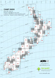
D3/D4 VNC Queenstown/Manawatu - (1:125,000) - 30 November 2023
$14.50 NZDEffective 30 November 2023
This chart is 1:125,000 scale at an A1 sheet size and covers:
- Queenstown Terminal Area
- Manawatu Terminal Area
Visual Navigation Charts (VNC) are intended for pre-flight planning and in-flight navigation.
The 1:125,000 scale covers the Auckland, Christchurch, Queenstown and the Manawatu terminal areas in four charts (2 double sided sheets).
Notes:
Aeronautical information is incomplete on this chart above 9500ft. Refer to A series (1:1,000,000) charts for planning and flight above 9500 ft.


